Natural Flood Management in the Forest
Since November 2020, we have been looking at more ways to improve and create wetland habitats within the Heart of England Forest. As well as having great benefits for wetland biodiversity, this includes the creation of what we call natural flood management features to alleviate flooding. Imogen Rutter, Biodiversity Officer, explains more and shares how we are implementing this in our projects at Oak Wood and Pitchell Wood.
Natural ways to reduce the risk of flooding
Natural flood management is using natural features and emulating natural processes within the landscape to slow down the flow of water through the catchment. The catchment of a river is defined as the area or drainage basin that captures rainfall and drains into a watercourse. These management measures can be considered instead of, or alongside, other more major engineering works to alleviate flooding.
In some respects, natural flood management is said to mimic the process of beavers, which are key ecosystem engineers, by creating wetlands, leaky dams made of woody debris, and storage ponds. In the absence of beavers, we can try to replicate some of these features at strategically planned locations to help hold water upstream in the catchment for longer.
Slowing the flow
In the Spring 2020 edition of our supporter magazine, we talked about how planting trees can help with natural flood management by uptake of water through their roots, evaporation of rain droplets caught on leaves, and through extensive root networks helping water to penetrate deeper into the soil. Tree planting is just one of many interventions that can be used to ‘slow the flow’.
Our landscape today has been modified to make it less and less permeable through hard paving of urban areas, the conversion of natural habitat to other land uses, and the compaction of intensively-managed agricultural soils. This means that our landscape is less able to capture water by holding it in soils and vegetation, or allowing it to percolate through into permeable rocks below. Instead, water flows overland, quickly collecting in rivers and then overwhelming flood defences that can no longer cope.*
Slowing the flow stops this rush of water and lets it out more slowly, so that flood defences are not breached. With more than 5 million properties in England – 1 in 6 homes – at risk of flooding, this is a vital way in which the Heart of England Forest can enhance the quality of life for people.
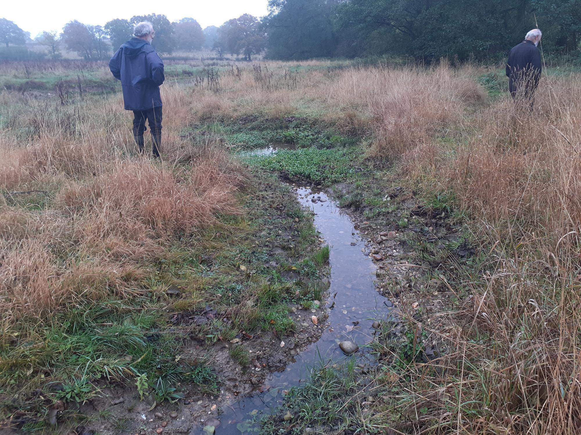
There are elements of natural flood management techniques in two of our recent wetland projects, at Oak Wood near Trap’s Green, and Pitchell Wood near Broad Marston. At Oak Wood elements of natural flood management were created through the addition of storage ponds, blocking of drainage ditches,.and the creation of more diverse features and habitats within the channel of the tributary, for example, adding in gravelly bits, areas with deeper pools, and side channels that branch off from the main one.
All these features help to slow down water by giving it more places to go and holding it on the land for longer. At Pitchell Wood, a seasonal wetland area has been created using a scrape and bund.
Elements of natural flood management

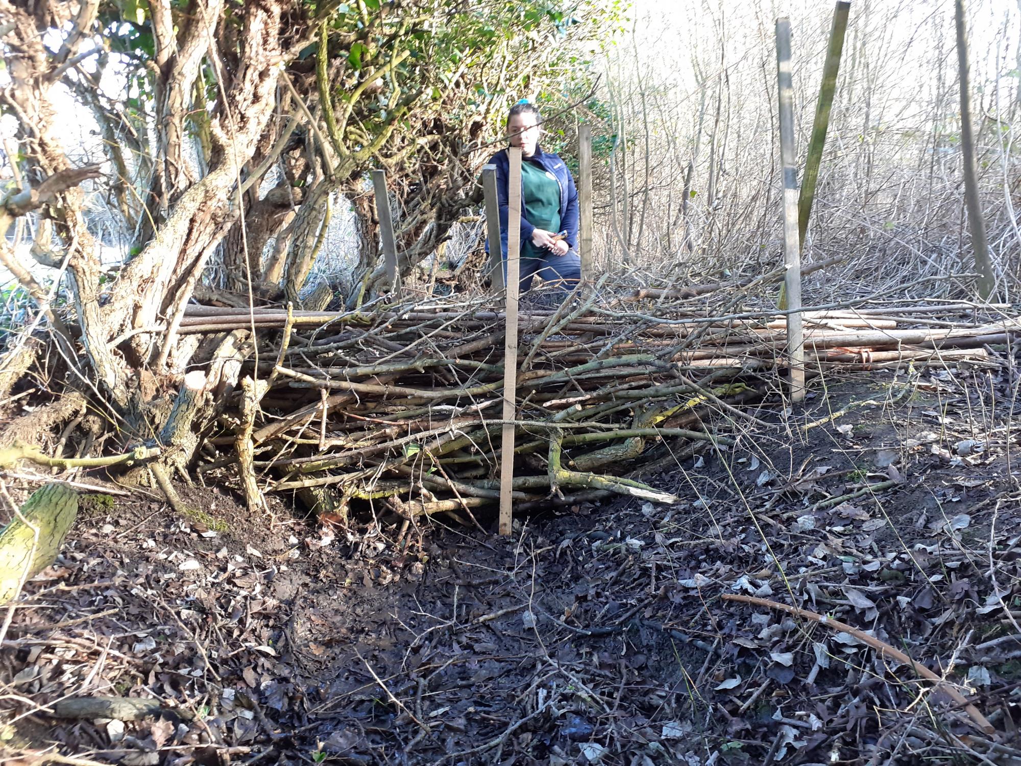
Leaky dams/large woody barriers
The role of leaky dams is to mimic naturally fallen woody debris or fallen trees that builds up in a channel and causes a natural dam. These are often over-looked, yet vital components of our rivers, and have the function of holding back floodwater, temporarily reducing the downstream peak.
They hold back water in the channel or push water onto the adjoining banks, as well as trapping sediments and pollutants. The presence of woody debris helps stabilise riverbanks and prevent soil erosion. Woody habitat is also a fantastic feature for wildlife, creating sheltered areas for dragonflies, damselflies, and other river flies to emerge from their larval stage, as well as providing shady, slower-flowing areas for fish to spawn. Quite often, woody features will appear naturally in a river over time, and usually the best advice is – don’t tidy up, leave it in there!

Creating ponds and scrapes
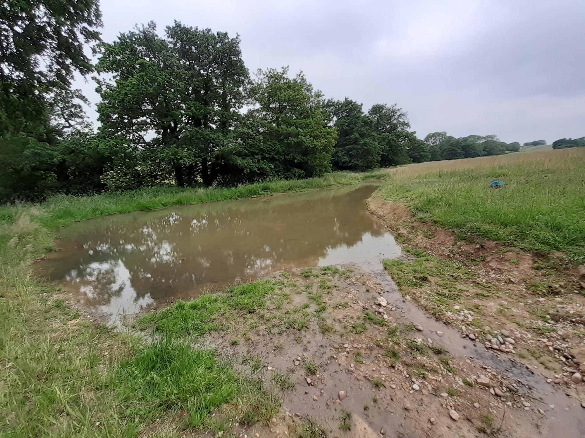
Ponds and scrapes have two functions; they capture and store both ground and rainwater flows during flood events, and may also act as sediment traps if they lie in the pathway of surface runoff.
This is true in the case of our new ponds at Oak Wood – two of these received redirected water from the network of land drains and drainage ditches. One receives mainly rainwater, and the other is an “online” pond – a pond that is directly connected to the watercourse. These ponds all store floodwater temporarily and release it back to the stream in a more gradual and controlled way, avoiding flash flooding further downstream.
Bunds and basins
The addition of a low earth bund (less than, say, 50cm) positioned across a flow pathway can help to retain water in certain areas. When combined with a shallow basin or scrape set behind the bund, this can create an area that holds standing water in wetter times of year, but then slowly disperses through either gradual ground infiltration, evaporation, or slow release through a built-in mechanism.
At Pitchell Wood, the location of our most recent wetland project, we have created a scrape and low earth bund which blocks the most common flow route and flooding pathway of rainwater through the site. This will collect to create a seasonal wetland area, then gradually evaporate or infiltrate into the ground. In cases of extreme wet weather events where water overflows from the scrape, it will be directed into a second overflow pond, and then back into the brook via a pipe.
Blocking of land drains and drainage ditches
This is a technique commonly used in the uplands to restore blanket bogs, but which can also be used in lowland areas. Most areas of land used for agriculture in their history will, at some point, have had extensive networks of land drains and drainage ditches dug. This was generally done to create drier and larger areas for grazing of livestock and growing arable crops. Unfortunately, this also reduces the flood storage potential of the land and results in water returning to the river catchment at a faster rate.
Using rainfall and hydrology models, we are starting to look at targeting specific underground land drains to dig down to and block up in areas where we can accommodate more standing water on the land within the Heart of England Forest. This also helps to create flashy, wet grassland areas (rather than deeper ponds), which is fantastic habitat for many wader species, including snipe, curlew, redshank and lapwing.

Restoring river meanders
Restoring river meanders and floodplain connectivity are large-scale approaches that require a lot of planning, and in some cases aren’t feasible, but have by far the most impactful effect on the surrounding environment.
Historically many of our river tributaries have been straightened and over-deepened to be more like canals, for the purpose of increasing areas of grazing land, or to protect certain areas of farmland from flooding. Unfortunately, the disconnection of river from floodplain and decreased storage capacity only sends the water downstream faster, which means flooding problems are pushed further down into the catchment, often to areas with more housing, rather than having water naturally stored as part of a floodplain as it is supposed to do.
In areas where it is practicable, rivers can be modelled and restored to their original shape, with bends, meanders, and a more diverse geomorphology than when they are straightened and over-deepened.

Better for biodiversity
In addition to slowing the flow of water, all these natural flood management techniques provide better habitat for a variety of species within the river and floodplain. Case studies of these types of projects have shown fantastically swift results for fish spawning, insect populations, reduction of soil and gravel erosion, and reduction in water speeds through the channel.
In the future, as we develop more projects in the Forest, we hope to create more areas of wetland habitat to hold water on the land for longer using a combination of these techniques, from revisiting land drains at Oak Wood to modelling the feasibility of larger-scale river restoration, for example around the Noleham Brook.
You can read more about how we created wetland at Oak Wood here.


